« May 2010 | Main | September 2010 »

July 2010 Archives

July 23, 2010

France’s Circulade Villages

By Bruce Robbins

For a thousand years, the unique circular pattern of a series of hillside-hugging French villages remained, to all but their inhabitants, undiscovered.Photo courtesy Murviel Tourist Board

Then, in 1992, Polish architect Krzysztof Pawlowski took to the air and laid bare, from his bird’s-eye perspective, the concentric layout of Europe’s first stab at town planning.

Pawlowski called the 50-plus medieval settlements he identified whilst soaring above the Languedoc-Roussillon region “circulades.”

Successive generations of French families have lived and died in these villages, their tall, narrow homes and cheek-by-jowl living conditions forging community bonds that are as resistant to incomers as the circulades once were to outside attack.

Spiralling up baked hillsides in the hot and dusty South of France, bounded by the Mediterranean to the east and the massive bulk of the Pyrenees to the south, the circulades grew up in the 11th and 12th centuries, a turbulent time when security and safety were tenuous notions.

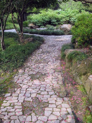
The rings of houses provided a succession of ramparts that could be defended by small forces and which shielded the core -- usually a castle or church -- from marauding crusaders. Today, the villages, found mostly in the Herault and Aude departments, are under attack from a much more benign force -- tourists -- who love to wander the winding lan
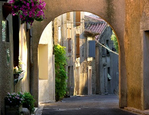
es intersected with little alleyways and flights of ancient stone steps.

One of the largest and most charming of the circulades is Murviel les Beziers, which takes its name from “muri,” meaning “walls,” and “vetuli,” literally “old man.” When the two are combined, they assume a new meaning, “old walls.” Many of the walls of the village homes are painted in bright, fetching colors and adorned with baskets of overflowing plants that need careful and constant attention in the hot, dry climate.

The Mediterranean sun -- Murviel is just 30km (18.5 miles) from the coast -- can be intense in this part of Herault but thankfully the serried ranks of houses cast a cooling shade either side of high noon. The village is decidedly not car friendly so it’s best to park on the outskirts where it’s never any more than a few minutes’ walk to the ancient heart.

That heart was once a castle that belonged to the Lords of Murviel until the early 19th century but is now the Chateau de Murviel, an upmarket bed and breakfast establishment that offers panoramic views of the surrounding countryside.

If you’re lucky enough to visit Murviel during July and August, you’ll be won over by the villagers’ charming tradition of placing life-size dolls on the streets. Known as Les Petetas, they’re made from rags and corn and are a celebration of the corn and grape harvests which, along with olives, have long been important elements of the local economy.

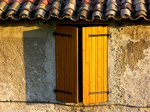
Around 2,500 souls call Murviel home and their daily needs are served by a supermarket and a number of small village shops. But don’t expect Murviel to provide round-the-clock entertainment -- or entertainment of any sort, really. When it comes to things to do, “sleepy” would be the best way to describe this circulade.

That might suit you down to the ground, but if you’re the more adventurous sort, all the facilities associated with the Mediterranean are just a half hour’s drive away.

And city dwellers who come out in a cold sweat when faced with an open landscape or a quiet village -- no matter how lovely -- can seek refuge and some solace in the bustling nearby towns of Beziers, Pezenas and Narbonne.

If you wish to purchase this article for your publication, click here to contact the author directly.

*aerial photo courtesy Murviel Tourist Board

Crotto Ombra: A Chiavenna Cave Restaurant

By Diana Russler
ITWPA Member

Hidden in the middle of the Italian Alps not far from the Swiss border is the lush Valchiavenna valley where a tradition of hearty food is the perfect antidote to a long day of outside activity.

Chiavenna, the main town on an ancient north-south trade route, is riddled with numerous natural caves and underground passages formed millions of years ago after earthquakes and landslides brought tons of large boulders crashing down. A consistent stream of air at 48°F wafts through the caves, making them ideal natural larders which have been used for thousands of years to store meat, cheese and wine. Restaurants have been added to many of these caves (crotti) where locals and visitors alike gather to share a glass of Valchiavenna wine and sample the traditional food of the mountains.

Crotto Ombra Restaurant is one such cave restaurant. Its name comes from the shadow (ombra) of a gigantic boulder sitting atop the cave. Inside, a 160-foot-long passageway lined with wooden shelves is home to almost 5,000 giant yellow wheels of the famous local Bitto cheese. The chilly air is pungent with the aroma of aging cheese. Although most of these cheeses are aged for only about 70 days, others can sit in silence for up to 10 years.

Friendly, smiling waiters welcome you to a wood-paneled dining room where bright yellow tablecloths add to the cheery mood. There is a large patio with picnic tables and benches for outdoor dining.
 
The menu is simple, featuring Bresaola (beef rubbed with spices and air-cured in the Valtellina), Pizzocheri (local buckwheat pasta), polenta, venison ragú, pork, and gnocchi. The wine list focuses predominantly on products of the area -- Grumello, Sassella, and the house wine (called Chiavennasca by the locals) -- although other Italian wines are also available.

Try the bresaola as an appetizer. It is served sliced paper-thin, the dark-red meat drizzled with extra virgin green olive oil and a spritz of lemon juice. A sliver of Parmesan cheese graces the top. The meat is moist and delicate, the flavors enhanced by the Parmesan cheese.

The regional dish of the Valtellina is Pizzocheri alla Valtellinese, a plate of dark buckwheat flour pasta served with butter, chunks of potato, cabbage, and local soft cheese melted into the steaming pasta. Although some would argue that this dish is best suited for the winter, it tastes delicious in any season after a strenuous hike.

The venison ragú, stewed in red wine and flavored with aromatic herbs, arrives atop a plate of sage-flavored steaming yellow polenta. The rich flavors of the meat are offset by the simplicity of the polenta, making this a truly soul-satisfying dish.

If you are still hungry, try the Crotto Ombra Bitto cheese, served with fruit. The slices of rich, nutty, tangy cheese come straight from the cave.

Finally, end the meal with a bowl of fresh wild mountain strawberries and blueberries or a bowl of homemade gelato and a cup of steaming espresso.

After such a satisfying repast, a stroll through the ancient 16th century town along the River Mera will help you digest as you marvel at the natural beauty of the surrounding mountains.
 
TO GET THERE

Fly to Milan and rent a car at the airport. Several U.S. carriers have direct flights to Milan from the U.S. Most major car rental companies are represented at Milan’s Malpensa Airport.

Drive north from Milan to the eastern shore of Lake Como to the SS36, which takes you all the way to Chiavenna. Crotto Ombra is on Viale Pratogiano 14 (23022 Chiavenna SO), Tel 39-0343-290133.

If you wish to purchase this article for your publication, clich here to contact the author directly.

Red Rock Canyon

By Jerry Lustig

Whether you’ve been there before or you’re planning a first-time trip to Las Vegas, don’t spend all your time in the casinos. There’s so much more to see and do, especially in the summer when the days are longer and the weather is warmer.

Take a day to explore Red Rock Canyon. Just 17 miles west of downtown, off Charleston Boulevard, lies one of Mother Nature’s remarkable achievements. On the eastern edge of the Mojave Desert this 195,819-acre natural phenomenon, a national conservation area, draws a million visitors a year to explore its wonders. (Legend has it that none go home disappointed.)

A very short drive off the highway brings visitors to the welcome booth, where a modest $5.00 fee per car is collected. That’s right, just $5.00 per car (passengers are free). A short hop, skip and jump brings you to the new visitor’s center and gift shop manned by volunteers who greet visitors with a friendly smile and a real desire to be helpful. Then it’s on to the 13-mile, one-way loop drive through the canyon. Along the way there are places to park (several with rest stops) for viewing the amazing rock formations in sandstone, gray and shades of red.

In the words of the Red Rock Casino Resort Spa, “The Red Rock Canyon presents awe-inspiring views most wouldn’t expect to see near a major metropolitan city. In contrast to the bright lights and hype of the strip, Red Rock offers desert beauty, towering red cliffs and abundant wildlife.” About 200 species of mammals, birds, reptiles, and insects live in the park. Visitors are warned to stay clear of all living flora and fauna for their own safety as well as for the animals’.

The mountains surrounding the scenic drive were formed over millions of years by the movement of the earth’s crust in concert with other geologic forces and fossilized sand dunes. Centuries of interaction between iron oxide and sandstone produced the brilliant red colors on many of the canyon walls.

For those seeking more energetic activities there are hiking and bicycle trails and the ultimate experience, rock climbing. Before embarking on any of these activities, because of the varying degrees of difficulty, enthusiasts are urged to discuss their plans with the park rangers. Camping grounds and picnic areas are also available. But please bring your own food and water.

After completing your tour around the canyon, stop again in the visitor’s center, check out the exhibits and peek into the gift shop, where many artifacts and other remembrances of this experience will tempt you to bring something home to be cherished and shared with friends and relatives.

And speaking of cherished memories, don’t forget your camera and binoculars.

* Red Rock Casino Resort Spa is located about 4 miles east of the canyon off Charleston Boulevard. If you’re looking for a Las Vegas resort with less glitz and more sophistication than you are likely to find along the strip, this is the place for you. It’s got it all: a huge casino, multiplex theatre, bowling alleys, fine dining and a food court, shopping, a business center, meeting rooms, ballrooms, spa, beautiful guest rooms, and so much more. The appointments throughout the public areas are classically subdued and meticulously maintained. The staff are friendly and well trained in their jobs, courteous and helpful. If you ask a staff member where something is they’re more than likely to take you there personally.

If you wish to purchase this article for your publication, click here to contact the author directly.

Ennis, Texas Bluebonnet Festival

By Kristin Faulk

It’s Saturday morning and it’s cloudy and damp with a slight mist hanging in the air. I find myself traveling south of downtown Dallas, along Interstate 45, with Ennis, Texas as my destination. Why? Simple really. Ennis’ atmosphere is reminiscent of a little country town, population 16,045, with a down home feeling. Bluebonnet gazing, a popular spring pastime, makes Ennis a great side trip destination for the whole family. Thousands of visitors make this annual trek, some having made visiting Ennis a family tradition.

A strategically placed banner hangs high, welcoming each guest. Following the parade of vehicles down to Main Street, you may hear the faint strains of a polka melody filling the air. Peruse the many booths filled with handmade items. Visit some of the antique shops that line the thoroughfare. Be tantalized by the aroma of home baked goodies like fudge and freshly roasted peanuts…or take the kids on a pony ride.

Housed in a huge white tent, the “visitor’s center” is where you pick up a map as well as written directions and a little history for the bluebonnet trails. Take snapshots, picnic or just relax and commune with nature while fields carpeted in deep blue and ablaze with splashes of orange wait to tease your senses.

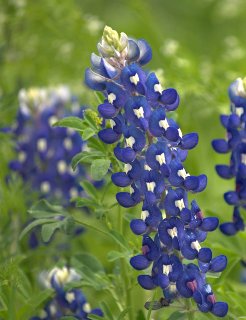
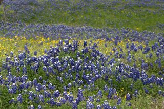
The bluebonnet season starts April 1st and runs until April 30th. The festival is generally the 3rd weekend of the month and it is advised that visitors check for the best time to visit. Flowers vary from year to year due to weather, terrain, and the peak time of the flowers. For the latest information, contact Ennis Convention and Visitors Bureau at 972-878-4748 or visit their website.

If you wish to purchase this article for your publication, click here to contact the author directly.


Cobh, Ireland: On the Titanic Trail

By Bob Kelley
ITWPA Member

Long before Jack, Rose and the Heart of the Ocean sailed into movie legend, I was a bona fide “Titaniac.” Planning my second visit to Ireland, I wanted to do more than kiss the Blarney Stone again and visit ancient ruins. I was determined to check out Queenstown, the fabled ship’s last port of call. With no sign of Queenstown on my Irish map, research showed it is now known as Cobh (pronounced “cove”).

Cobh is located on the south shore of the Great Island in Cork Harbour (one of the largest natural harbors in the world). This sleepy town with its building facades sporting traditional Irish pastel colors of blue, yellow, pink and green sits on south-facing slopes overlooking the entrance to the harbor. St. Coleman’s Cathedral, the town’s most distinguishable landmark, crowns the top of the slopes, its 300-foot spire piercing the brilliant sky.  

Early in Irish history, the island was known by several different names that roll off the tongue like the words of a lilting Celtic ballad: Oilean Ard Neimheadh, Crich Liathain and Oilean Mor An Barra. 

The village on the island was known as Ballyvoloon. In 1750 it was first referred to as Cove village. To commemorate a visit by Queen Victoria in 1849, the town’s name was changed to Queenstown and it retained that moniker until the creation of the Irish Free State in 1922 when the more Gaelic-sounding spelling of “Cobh” was adopted.

On April 11, 1912, there were 123 Irish immigrants lining the tiny White Star Line pier on Scott’s Quay in Cobh. Each one clutched a ticket for passage on the largest ocean liner in the world and harbored a personal dream of a more prosperous life in America. As they boarded the tenders PS Ireland and PS America berthed at the quay, the small group became literally the last people to leave solid land to board the great ship, earning them a place in nautical immortality. Only 44 of them would survive the tragic sinking a mere three days later.  

The dilapidated remains of that pier still stand today next to the quay. The old White Star building is there, too, even though its interior has burned twice in the past decade. Across the street, in Pearse Square, a memorial pays tribute to those lost on the Titanic. The bronze relief on the monument depicts passengers being ferried out to the ship plus an image of a lady with a brood of children. She is Margaret Rice, a 39-year-old widow, who was heading to Spokane, Washington with her five sons, aged 2-10. They did not survive the sinking. The deaths of Ms. Rice and her children are notably the largest single family loss of all of the Irish families aboard the “unsinkable” ship.

These sites, plus 16 others relating to Cobh and the Titanic, are part of The Titanic Trail, a guided walking tour led by local historian Michael Martin. Cost is only 9.5 Euros and tours are held daily year round.  

Immersed in the mosaic of Irish history, Cobh is the real jewel in the Titanic saga, offering a rich tapestry of discovery, adventure and beauty. I was relieved merchants had resisted the temptation to cash in on its Titanic link. Missing are the shops full of Titanic kitsch and caboodle and instead I found a charming village where visitors can soak up the local warm hospitality and hearty Irish fare.

Additional interesting attractions can be found in Cobh such as The Queenstown Story dealing with Irish immigration (2.5 million immigrants left from this “Gateway to the New World”), the 750-acre Fota Island (a nearby wildlife preserve), and historic ties to another maritime disaster, the Lusitania.

For more information about The Titanic Trail, including hours, minibus tour details and directions, go to www.titanic-trail.com.


Sources:
Michael Martin, The Titanic Trail, “A Heritage Journey Across the Mists of Time” www.titanic-trail.com

If you wish to purchase this article for your publication, click here to contact the author directly.


Shanghai’s Fine Gardens

By Ifang Hsieh

Tourists visit Shanghai because it is historical and modern, oriental and westernized, a strange yet exhilarating must-see destination. The best locations to observe and relish these multi-faceted qualities, to one’s surprise, are Shanghai’s fine gardens, found in both the urban and suburban districts.

In ancient China, artists and literati created splash ink paintings and composed poetry to commemorate their travels and Nature’s wonders. Some wealthy or aristocratic individuals went a step further. It is well documented that many masters constructed magnificent private gardens with gigantic, peculiarly-shaped rocks they transported back home from faraway places, sometimes bankrupting their families. Today such architectural undertakings would be viewed as destruction of nature.

YuYuan Garden, a sumptuous artificial oasis infused with the opulence and elegance of yesteryear and adorned with elaborately-designed ponds, bridges, halls, corridors and verdant landscaping, was built in 1559 during the Ming Dynasty. Visitors are presented continuously with image after image of delightful garden scenery out of some enchanting ancient Chinese novel. Upon leaving the park visitors are greeted by the liveliness and clamor of the surrounding commercial area -- the oldest and most touristy part of Shanghai, seemingly a world apart.

If you wish to be somewhere where you can whisper or shout amidst bamboo trees (one of “Four Noble Plants” in Chinese art) swaying in the wind, closely examine a splendid peony blossom (considered the finest flora in Chinese culture), saunter on exquisitely-paved cobblestone paths at any chosen speed, and photograph your stroll to an ancient pavilion or on a stone bridge without waiting in line, visit QiuXia Garden. Constructed in 1502, also during the Ming Dynasty, QiuXia Garden is in suburban JiaDing District. You’ll unearth a most precious hidden gem of vast Shanghai.

YuYuan Garden and QiuXia Garden are two of the five finest classical botanical gardens in Shanghai. The other three are QingPu District's QuShui Garden, also called the Garden of Meandering Streams, JiaDing District’s GuYi Garden, and SongJiang District’s ZuiBaiChi Garden. It will not be excessive for you to visit all five gardens as each is unique and indelible in its own way.

If you wish to purchase this article for your publication, click here to contact the author directly.


About July 2010

This page contains all entries posted to Travel Post Monthly in July 2010. They are listed from oldest to newest.

May 2010 is the previous archive.

September 2010 is the next archive.

Many more can be found on the main index page or by looking through the archives.

Powered by
Movable Type 3.33